
G-Day!
For today’s post, following on from yesterday’s inspired post I have decided to talk about something totally different. I would like to start over a series of blog posts to talk about the various walks, hikes and treks that Winnie and I did whilst we were on our Road Trip from Adelaide to Darwin. I will only cover the walks that we actually did, and give an honest appraisal of them. To do them justice I will cover one walk each time I post on this subject – so stay tuned for the other walks!
No discussion of the Red Centre of Australia would be complete without a mention for that big old red rock that millions flock to see each year – Uluru, or as it is also known Ayers Rock.
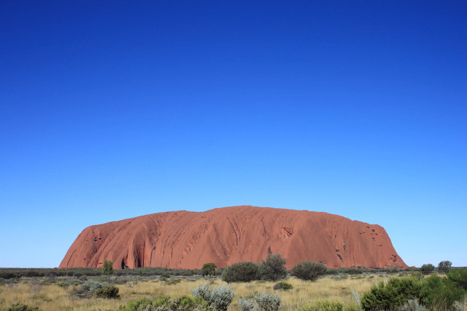
Uluru stands at around 800m high, and can be seen far off into the distance – long before reaching the National Park entrance. After driving for a few days prior without a blemish on the horizon it is very easy to confuse it with Mount Conner which is around 114km East of Uluru-Kata Tjuta National Park. It is still a pretty cool looking rock, and great for a photo. In the interest of being honest, I did get confused but you can forgive the Pommie for mistaking rocks in the outback of Australia!! See Mount Conner:

On arrival at the Uluru-Kata Tjuta National Park, you’ll be required to pay $25 per person (adult price) for 3 days of access to the park. You’ll be given a ticket, which to validate you just need to write your name on it. Next follow the very detailed maps that are provided to drive to Uluru, and decide which car park to stop in. From the park entrance its about 20-30km to Uluru! The roads are well sign posted and the park is patrolled by knowledgeable Rangers, who are really friendly. There’s plenty to do here, and 3 days can fly by.
1 - Visit the Cultural Centre
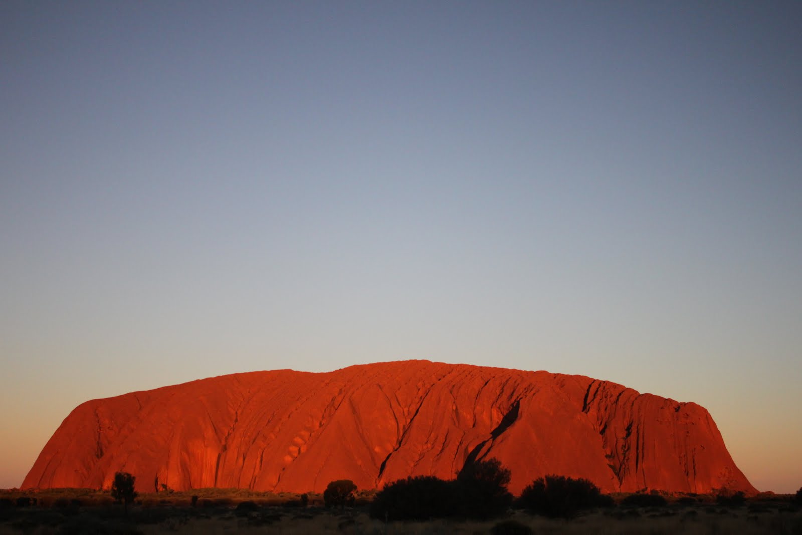
2 - Sunrise & Sunset Viewing of Uluru
3 - Walks of Uluru
4 - Sunset Viewing of Kata Tjuta
5 - Walks of Kata Tjuta
The park opens before sunrise and closes just after sunset – 6am until 8pm.
We decided on parking at the MALA walk car park – we even found a friendly “Wicked” Van to park our "Lennon" next to!

OK so what do you need to think about BEFORE taking on any hiking in the Australian Outback? I have put together a little guide, based on what worked for me and Winnie:
1 - Wide Brimmed Hat / Baseball Cap & Fly Net
2 - Sunglasses – good quality eye protection is needed
3 - Lots of Sunscreen and regular application
4 - Lightweight Breathable Clothing, at least one layer to be long sleeved (which you can wear if you start to feel sunburn)
5 - Sturdy Walking Shoes or Boots
6 - HYDRATION – lots and lots of hydration.
7 - Some light snacks for during the walk.
The NT Government and National Parks have signs and recommendations placed at each walk. A common recommendation is that each walker requires at least 1 litre of water for every hour they are walking. We found the use of a hydration bladder to be the best method, since it stays cool for longer than standard water bottles – which we also carried. On every walk we did in the outback we carried 3 litres of water each (2 litre bladder and 1 litre bottle). I drank everything on most of our walks and Winnie normally used 1.5 – 2 litres on each walk. Another GAFFA tip is to have comfortable hiking socks and clothing that wicks your sweat so you feel cooler and more comfy. So here’s what we were wearing:


Now onto the Uluru Base Walk. This is a fairly easy terrain walk, basically following a dusty track that is wide, largely flat and not very challenging. I believe you could push a wheelchair or children's pushchair around this with relative ease. It is a lovely walk that takes in the whole of Uluru. It is 10km and there are a couple of first aid shelters and drinking water check points along the route. The walking tracks have been designed to provide a comfortable and safe experience whilst protecting the local environment. Please stick to the tracks.
There are regular interpretive markers that teach people about the cultural significance of Uluru as they walk around the park, and these also provide excellent mini-breaks if you get tired! The base walk runs clockwise around Uluru, but you can opt to walk in the other direction if you prefer. Winnie and I walked clockwise, following the Mala walk until it linked up with the Base Walk.
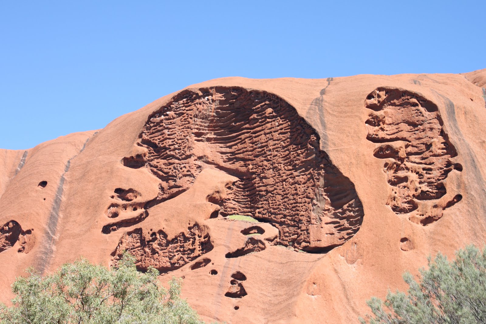
The walk takes you past Kantju Gorge heading north-east. Along the walk you should see heaps of beautiful colours from the diverse array of flora and fauna. I was captivated by the almost neon colours of the numerous butterflies – AWESOME! But they’re very tricky to catch on photo. There’s lots of great photo opportunities along this route, including some really interesting features of Uluru that you never see in professional photos, like the cuttings and cracks formed in the side that look like a skull (in Winnie’s opinion), see for yourself:
You’ll pass over a couple of little streams / creeks and walk through some shady woodland – which I was not expecting out there in the Outback! Infact, to be honest due the heavy wet season and extensive flooding in late 2010 and early 2011, I suspect that nature has painted a non-standard canvas of colours this year! One thing you will pick up along your walk, in abundance, is friendly flies. They get everywhere (and I mean everywhere). In the interest of keeping our budget low, we opted out of using fly nets on this walk –
BUG MISTAKE!
(ha ha ha) get it BUG mistake!!! =) Buy a fly net, you WILL need it.
In my opinion it is worth taking this walk. It’s so relaxing and quiet. You can hear the birds singing in the nearby woodland, and you can really take the time to think and reflect. You’ll pass the many sacred sites, and a display of diverse geology, plants and animals of the park. The walk eventually returns southward from Kunya Piti on the South-Eastern most point of the base walk. There is a car park and some more interpretive markers to explain Kuniya and Lungkata Tjukurpa. The Kuniya walk leads off of the base walk track to the Mutitjula waterhole and back again. It’s a nice shaded diversion, and well worth the extra 5-10 minutes.

Onwards from there we continued south on the Lungkata walk around the south-western side of Uluru, finishing back at the Mala carpark....10km later. It took us around 3 ½ Hours, with photo stops and a little break to rehydrate and eat a yummy peanut butter sanga...


Here are some of my favorite photos from the Uluru Base walk:


What still boggles my mind is that this walk was the equivalent distance to walking from the Spit Bridge to Manly, in the northern beaches of Sydney NSW!! Crazy.
"..Uluru’s a bloody big lump of rock, mate!.."
I hope you found this post interesting & useful?
Note:
I am currently learning to use a new DSLR Canon 500D camera, and any tips or comments about my photography that will enable me to improve are welcome. It is my hope to really show you all the world, as I travel, through my eyes (and lens).

No comments:
Post a Comment